Table of Contents
ToggleGetting to Sedona AZ
The closest airport to Sedona, Arizona is Phoenix International Airport. From the airport, getting to Sedona AZ is simple.
The drive north to Sedona takes approximately two and a half hours. Stay on the Arizona Veterans Highway for most of the journey, only changing to Highway 179 (the scenic byway) for the last 30 minutes of the drive. It is a scenic drive through a drastically changing Arizona desert landscape. Once you arrive in Sedona, you will have access to the 3 best spots for hiking in Sedona AZ.
Slide Rock State Park

About 7 miles north of Sedona, drive to Slide Rock State Park for your first hike.
Slide Rock State Park is an Arizona State Park located in Oak Creek Canyon. It takes its name from a natural water slide formed by the slippery bed of Oak Creek. Slide Rock State Park is one of the most popular recreation spots in Sedona, and is one of the top 10 swimming holes in the United States.
There are three short hiking trails in Slide Rock: two with a difficulty rating of easy and one with a difficulty rating of moderate. Given the hiking options and swimming accessibility, Slide Rock State Park is a top choice for hiking in Sedona AZ.
Visitor Information for Slide Rock State Park
Slide Rock State Park is open daily for most of the year from 8am to 6pm. In the winter months (December through February), the park is open to visitors daily from 9am to 5pm.
Slide Rock State Park entrance fee is $20 per vehicle on weekdays, and $30 per vehicle on Fridays, Saturdays, and Sundays. Entrance fees can be paid by credit card or cash, but exact change is required.
Coconino National Forest

For your second hike, visit Coconino National Forest. It is a 1.856-million-acre United States National Forest located in northern Arizona in the vicinity of Flagstaff, with elevations ranging from 2,600 feet to the highest point in Arizona at 12,633 feet. The Coconino National Forest is one of the most diverse national forests in the country with landscapes ranging from the famous Red Rocks of Sedona to Ponderosa Pine Forests, to alpine tundra. From Sedona, a popular trails within Coconino National Forest is Devil’s Bridge Trail via Dry Creek Road. This 3.9 mile trail near Sedona is considered a moderately challening hike.
Devils Bridge is the largest natural sandstone arch located in the Sedona area of Coconino National Forest. This is a great hike that offers breathtaking views of Red Rock country. This route is relatively short but does have a steep climb at the end. Although Coconino is a challenging trail, it is another worthwhile spot for hiking in Sedona AZ.
Visitor Information for Coconino National Forest
Devil’s Bridge Trail in Coconino National Forest is open to the public 24 hours a day.
Parking at the Dry Creek Vista trailhead is very limited. The city of Sedona offers a free shuttle service to the Dry Creek Vista trailhead from a designated park & ride within central Sedona. The service operates Thursday through Sunday and is free and open to the general public. Also, there is no charge for parking at the park & ride location. For more information on shuttle schedules and park & ride locations, please visit SedonaShuttle.com.
Bell Rock Loop Trail

For your third hike, Bell Rock Loop Trail is a quick 1.8 mile loop trail with beautiful views of Sedona’s famous red rocks. If you have extra time, hike the numerous side trails as well.
Generally considered a moderately challenging route, it takes an average of 43 min to complete. This is a very popular area for hiking, running, and walking, so you’ll likely encounter other people while exploring. The trail is open year-round and is beautiful to visit anytime.
The Bell Rock Loop hike in Sedona is conveniently located on the south side of town roughly half way between The Chapel of the Holy Cross and The Village of Oak Creek along Highway 179.
It’s about a 15 minute drive south from Sedona’s main square and if you plan to visit The Chapel of the Holy Cross this is a great activity to pair with that stop due to their close proximity.
Visitor Information for Bell Rock Loop Trail
Bell Rock Loop Trail is open to the public 24 hours a day.
Admission to Bell Rock Loop Trail is free, but arrive early because the parking lot gets very crowded.
Final Thoughts
Hiking in Sedona AZ is an incredible experience! The natural scenery is breathtaking and truly unique.
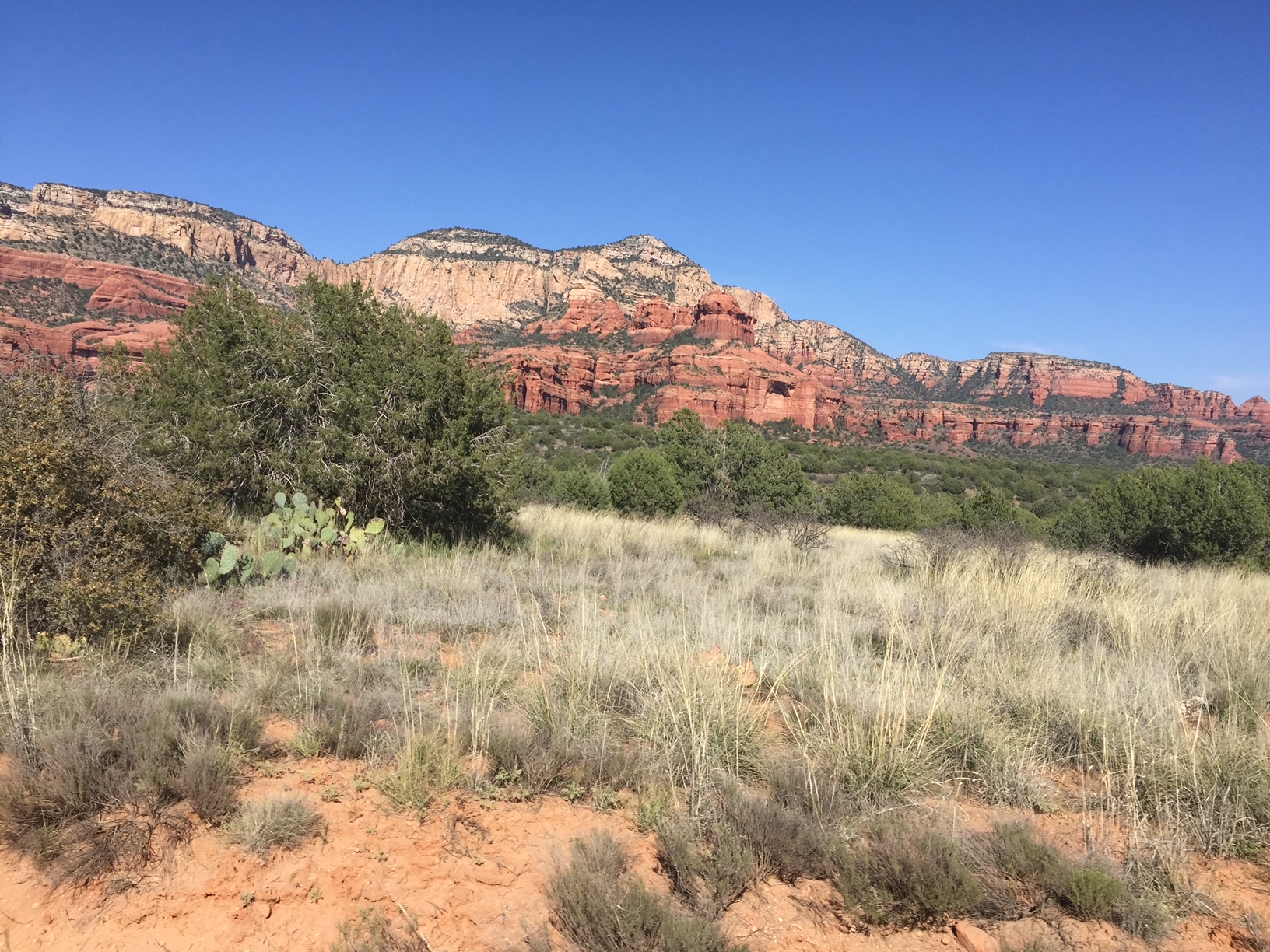
Red rocks are a staple of Sedona’s landscape. Anyone who comes to Sedona to see the statuesque red rocks knows that the area’s geology is what makes it so appealing.
Sedona’s red rock formations help reflect the sunrise beautifully, enhance the sunsets’ glow, and make everything in between more remarkable. While many people appreciate the red rock formations, not many know how they got there.
After 320 million years of changing ocean levels and the introduction of new sediments, the hard rock that began to form in Sedona had developed a thin layer of iron oxide (rust is an example of an iron oxide). This thin layer of iron oxide was caused by natural minerals’ chemical weathering and turned the rocks into their trademark red Sedona color.
By visiting these top 3 spots for hiking in Sedona AZ, you will have an unforgettable experience in this naturally wondrous place.
Happy Travels!


